
To hopefully make it easy to understand, I will paint this story by numbers.
1- it's where we live. And just in case you plan on stalking us like some other blog follower has done in the past, let this be a warning: I've got tools to keep you at a distance and I'm not afraid to use them!
2 - This is the bridge that is right out front of our window. We see it every day and we love it. The official name is Bryggebroen (The Warf Bridge) but it also has a nickname: The Swinger Bridge. You can see it in action here. I filmed this from our balcony in August 2014. Turn down or off your volume as it is just wind blowing in the mike. The swinging action starts at the 35 second mark. When it opened in 2006, there were estimates that 10,000 bikes would cross the bridge every day. Today there are over 14,000 bikes crossing the bridge every day and over 2,000 pedestrians. It sounds wild to me but those are the numbers.

*
3 - about a 20 minute walk away from our apt. is Langebro (Long Bridge). Just south, this side of Langebro, every summer, it is one of the trendiest places to hang out. There are parties and parties, sports events and parties, swap meets and parties, cultural faires and parties and parties and parties and parties.


*

4 - Right smack on the other side of Langebro, there are plans to get this bridge started in 2018. Above - you can see a drawing of what the bridge will look like and where it will stand in connection to Langebro. Below you can see a sample of how the bridge will be formed. (that's my bike) Take a look in the drawing and take a look at the new green glass building below. The bridge will connect this point where my bike is at and it will take you to the other side where that glass building is now being built. It's going to be a cultural center with options to do too many things to mention here. To find out more, click this link to see pix of what the building will look like and what it will be used for.

*
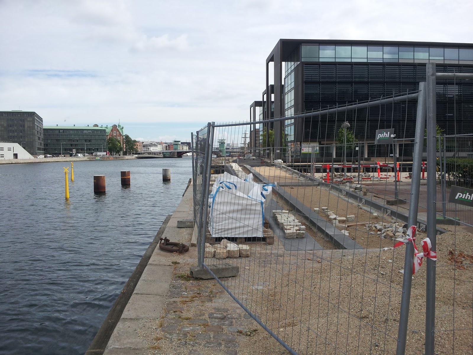
5 - I mentioned in my other blog about the bike ramp that was majorly delayed in being built. There were 3 bridges that were delayed by several years due to the building firm that went bankrupt. This is one of them. This bridge actually opened the day before our 25th anniversary. It's called Cirkelbroen (The Circle Bridge). It has a 'sail ship' look to it. It's made of 5 different size circles laid side by side and 2 of the circles turn away from the other 3 to make passage for boats - or something like that. I haven't seen it in action yet.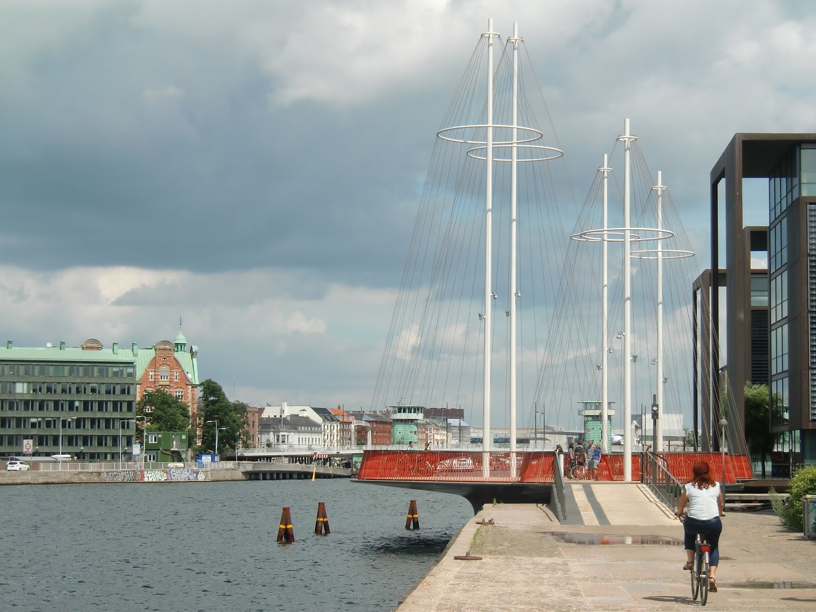
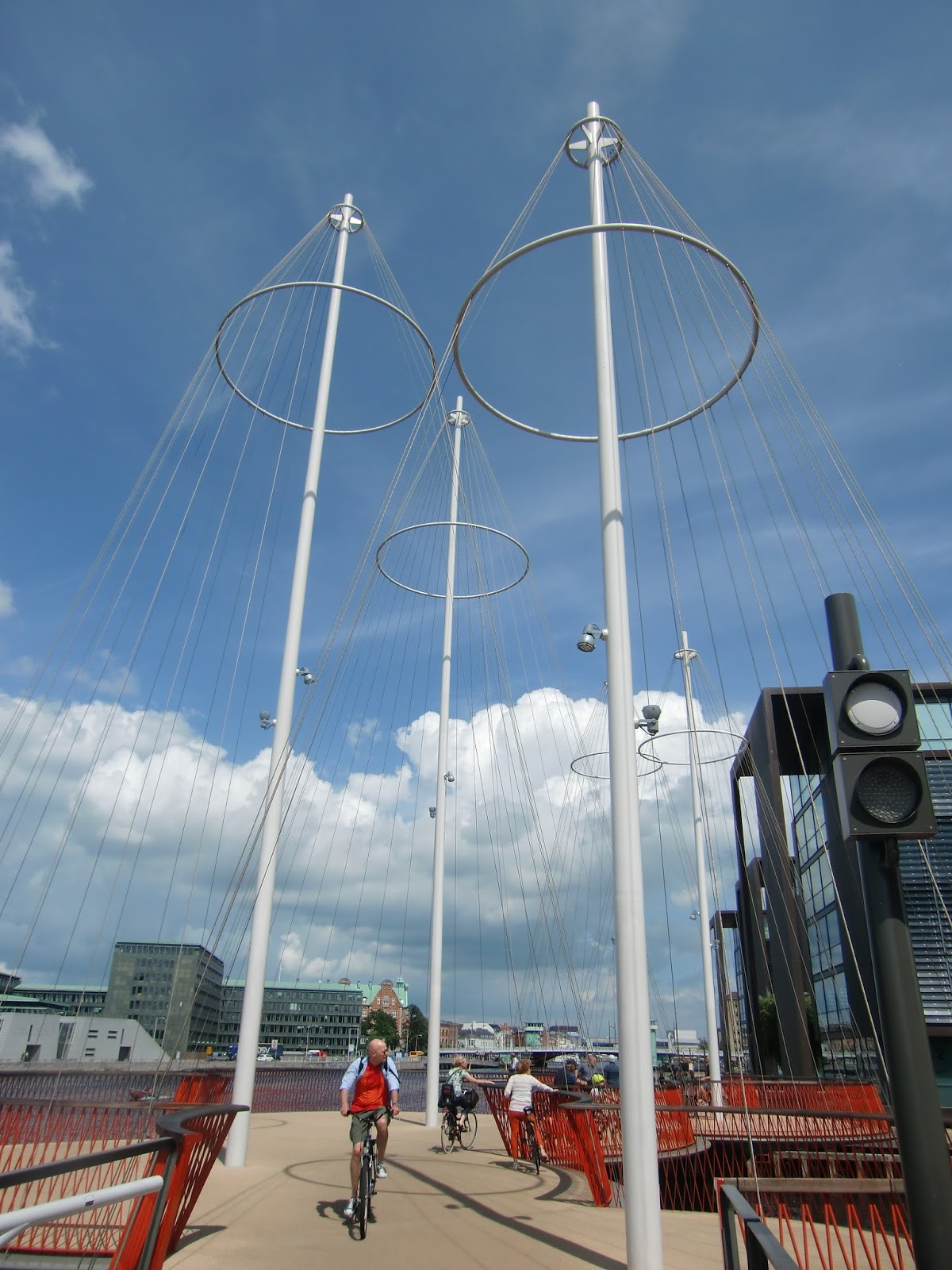

The following pix are of the Circle Bridge that I took over a 3 year period. There's not much too it and it really should have been completed in a few months.


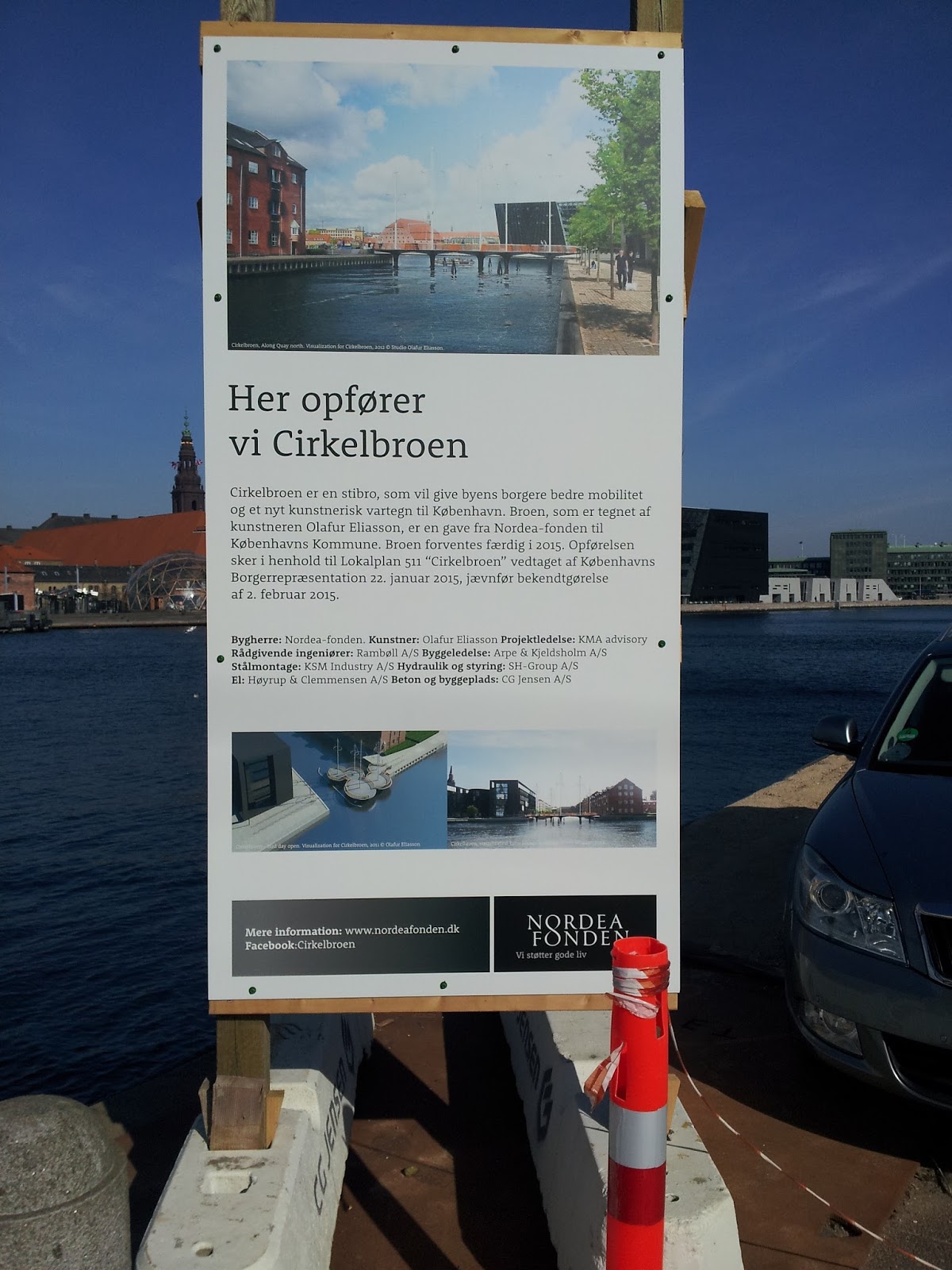


It's so simple - how could it take years to build?!
And it's so cute now, it's tempting to have a picnic on the bridge.
*

6 - Knippelsbro - who knows what the heck a knippel is? But to prove my point about Denmark being crazy about bridges, check out the national bank notes - Yeah, baby! Show me the money! On the front of each one of the Danish bills is a picture of a bridge that can be found in Denmark.

And on the 200 crown note is a picture of Knippel Bridge


*
7 - It opened in January 2015 but I did even know of it's existence until I accidently happened upon it in June last year (so it was only 6 months old at the time) while coming home from the Red Bull Diving competition. If you click the link, be sure to notice the screaming red color under The Knippel Bridge that I snapped while sailing to the diving competition - it's pix number 3. The diving competition was so exciting, I went again this year and most likely I'll be going again next year as well. Anywhoo..... This bridge is called Trangravsbroen. On Google Maps it says Butterfly Bridge - uh.... I don't think so. I don't know what Trangrav means. Jens says it doesn't mean anything. But I'm sure it had some sort of meaning back when an anonymous suggestion for the "Trangravsprojektet" was submitted to the city in 1874 . It's a 3-way bridge and each section lifts up separately. I just happened to catch the bridge on it's way down.


*

8 - But the bridge that the entire city of Copenhagen has been waiting for, for years to open, is this one: Inderhavnsbroen (The Inner Harbor Bridge). They actually kept the opening day a secret until the very last moment because they had announced the opening a number of times and only to the disappointment of the residents of the city. Last month they had a big celebration that you could now ride your bike all the way around the harbor. I was wondering how that was possible because the new bridge wasn't opened yet. Always problems - from bankruptcy to mechanical failure. Well surprise, surprise - it opened Friday, just last week. So I have been crossing my fingers for nice weather to give it a go. The weather was mixed but it was my day off so today was the day that I had my own little opening celebration. The bridge is very unique and very unusual but not really the most picturesque of structures, I must say.
When tall boats need to sail through, the bridge actually retracts. You can see the wheel mechanism under the bridge and the track that the upper part rolls back on.

Bike to one side - pedestrians to the other.


Here you can see the pedestrians on the left, the retractable part in the middle and the bike lane on the right. The part with the yellow colored glass is the part that will come this way and you can see the tracks that it ride on. The other half of the bridge does the same thing as well in the other direction.

The other building on the left is The Royal Opera House which among other things, is where the Red Bull Diving competition is held - from the roof!
And way in the background is one of the city's heating factories. It's too long to explain what that is but it's how we stay warm in this city. It's a huge monstrosity of a building that sends out heat to all of the homes and offices in the city. They decided to build the factory as a slope so that you ski down on it in the winter. It's not completed at the moment but when it is, it will totally give it a go.

Papir = Paper
ø = island
en = the
Yes, that's right: Paper island the.
house the, car the, boat the, water the, bridge the.....
the is always at the end of a definite article and put together as 1 word.

Straight ahead at the end of the bridge is the wonderful Nyhavn (New Harbor).
Nyhavn is for sure one of the main attractions of the city.

Waaaaaaaaaaaaaaaay in the background is a building with an angled roof.
That building is right across the harbor from our apartment.

I'm standing on Inderhavnbroen (8) looking at Knippelbroen (7) and under the arch, is the base of Langebro (3) and the angled roof building in the background is the from our neighborhood. My little bike ride around the harbor is a total of 7½ km / 5½ mi from our apartment to Inderhavnbroen and back. Be sure to take the ride if you are in town and be sure to stop in and tank up.
*

9 - I'm on my way back now and this is Christian IV's Bridge. Its not a very popular bridge among the Swedes. One year on the news, it was reported that a double decker tourist bus from Sweden drove on Christians IV's Bridge which leads directly under the very low lying Knippel Bridge. The tourist on the top level of the bus were killed when it smacked into Knippelsbroen. There are signs of caution everywhere. We just couldn't believe it when it happened again the following year. It's probably safer to ride your bike - as long as there's not an out of town tourist bus near by.


